Sustainable thermal planning in heavy industry — from steelmaking to chemicals — faces mounting pressure to decarbonize. Processes like coke production in steel plants release vast amounts of heat into the environment, even though they are essential for blast furnaces.
This “invisible energy” represents not just lost efficiency, but missed revenue opportunities and unnecessary CO₂ emissions.
For industries under strict environmental regulations, identifying and capturing these heat flows is no longer optional — it’s both a competitive advantage and a compliance necessity.
The Challenge: locating the opportunity
Waste heat is often diffuse, intermittent, and hidden within complex industrial layouts. Traditional recovery methods rely on site visits, manual measurements, and engineering estimates — all time-consuming and costly approaches.
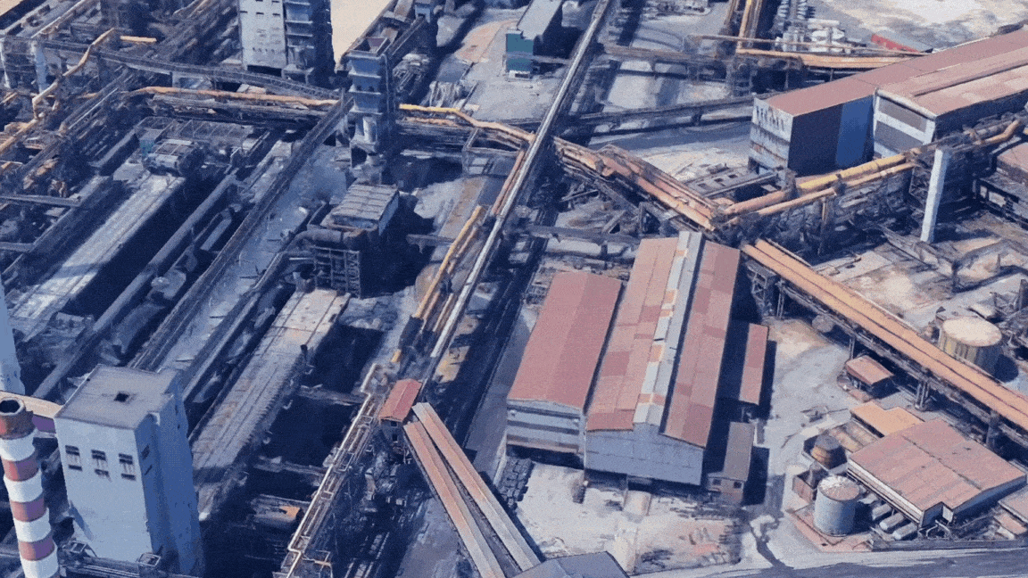
Weeks of on-site surveys reduced to minutes of AI mapping — always confirmed by human expertise.
Our Approach: AI-driven thermal opportunity mapping
We combine satellite imagery, geospatial analysis, and AI to detect potential sources and sinks of recoverable heat before ever setting foot on site.
Using high-resolution mapping, we identify:
- Major heat-emitting industrial sources
- Proximity to potential heat sinks (buildings, processes, or heat networks)
- Feasibility pathways for district heating integration or internal reuse
This approach enables decision-makers to quickly assess opportunities, prioritize investments, and align with decarbonization roadmaps.
While AI can quickly flag likely heat sources and sinks, our team cross-checks these findings against process knowledge, operational data, and regulatory requirements. This ensures that every opportunity identified is not only technically sound but also economically viable.
Why It Matters
By pinpointing the where and how much before investing in detailed engineering, you save time, reduce uncertainty, and accelerate your compliance strategy — whether for internal process reuse or district heating projects.
How We Support Your Project
• Pre-Development Site Analysis
We assess potential sites for new developments, evaluating environmental impact, technical feasibility, and energy demand potential.
• Site and Master Planning
We design comprehensive decarbonization and energy transition plans for large-scale developments, campuses, or districts.
• Regulatory & Funding Alignment
We create actionable plans that align with compliance requirements, capital planning needs, and available funding mechanisms.
• Advanced Modeling & Simulation
We apply cutting-edge modeling tools to quickly simulate scenarios and identify high-impact, cost-effective solutions.
Our Approach
By combining high-resolution demand and infrastructure data with scenario modeling and compliance expertise, we help you develop investment-grade proposals, meet regulatory obligations, and plan long-term, low-carbon transitions.
Get in touch if you’re considering waste heat recovery — and want to know exactly where the opportunities lie.
Want the technical deep dive? Please email us!
One response to “Sustainable thermal planning using satellite imagery + AI”
[…] combining detection with network design, we deliver a package that bridges early-stage opportunity assessment and […]